Quebec City and Charlevoix
Five days in the only walled city north of Mexico, then east along the St Lawrence into a meteor crater.
City Classic · 5 days · June to October
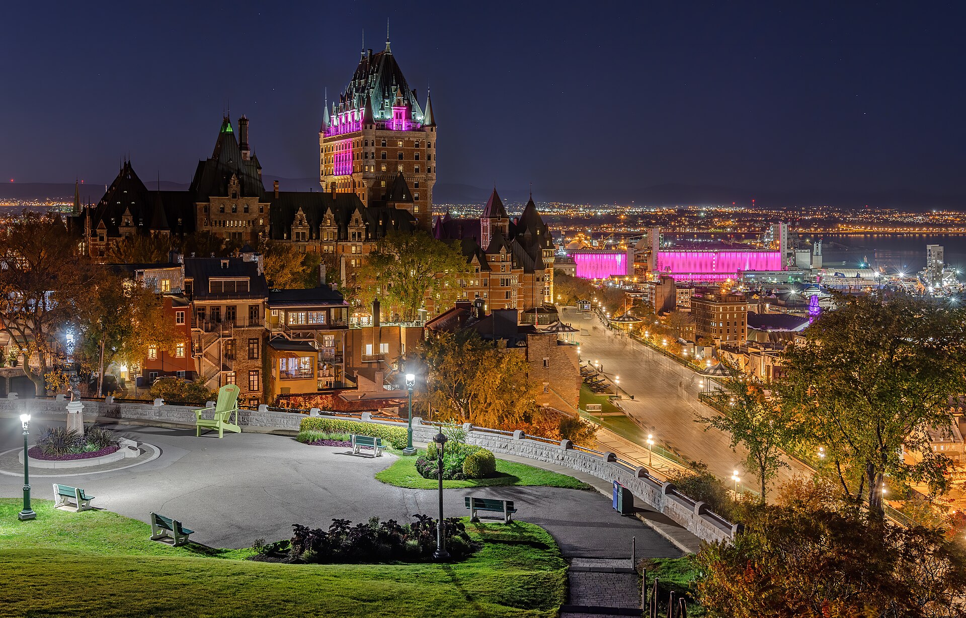
Quebec City is usually done in two days and treated as a stage set, which misses that the walls are still the working edge of a functioning town. Three days is enough to get past Chateau Frontenac and into the Saint-Roch kitchens, and then the drive east matters: Charlevoix is a fourteen-kilometre impact crater, farmed, with the river widening beside it until whales arrive at Tadoussac. Going in autumn is not a cliche here, it is the reason the road exists.
Day by day
- Day 1
Inside the walls
Arrive, get above the river, and walk the fortifications before dinner.
14:00Dufferin Terrace and the Governors' Promenade
A 425-metre boardwalk on the cliff edge, 60 metres above the St Lawrence, and the single best orientation to the geography of the city.
The boardwalk continues up 310 steps to the Plains of Abraham. The ruins of the Saint-Louis forts are under the terrace itself.
16:00The fortifications and Porte Saint-Louis
The only surviving fortified city walls in the Americas north of Mexico, and the reason the historic district is on the World Heritage list.
You can walk almost the entire 4.6 kilometre circuit on top of the walls. The Citadelle is a separate ticket and still an active garrison.
19:30Dinner in Saint-Roch
The lower town's old industrial quarter, now where the city's cooks actually work, and the antidote to eating inside the walls every night.
Twenty minutes downhill from the walls, or a short taxi. Book: the good rooms here are small.
- Day 2
Lower town and the battlefield
The oldest commercial street in North America in the morning, the field that decided the continent in the afternoon.
09:00Petit-Champlain and Place-Royale
Champlain built his habitation on this square in 1608, and Notre-Dame-des-Victoires on it in 1688; the street below is the oldest shopping street on the continent.
The funicular from Dufferin Terrace saves the Breakneck Steps. Both are worth doing once.
12:00Musee de la civilisation
The clearest account anywhere of how a French colony became a province inside an English country and stayed French.
Closed Mondays out of season. The permanent Quebec and First Nations galleries are the ones to prioritise.
15:30Plains of Abraham
The battle here in 1759 lasted about twenty minutes and decided who would run North America; both commanders died of it.
A 98-hectare park that Quebecers use as a park. The Martello towers are scattered across it.
- Day 3
Ile d'Orleans and the falls
An island of farms in the middle of the river, and a waterfall taller than Niagara.
09:30Montmorency Falls
Eighty-three metres, thirty higher than Niagara, dropping straight into the St Lawrence at the edge of the city.
The suspension bridge crosses directly above the lip. Cable car up, stairs down, is the right order.
12:00Ile d'Orleans, the loop road
Settled in the 1650s and never industrialised, so the seigneurial land divisions and the stone houses are still legible from the road.
Sixty-seven kilometres round six villages. Cassis, cider and strawberries in season, sold from farm sheds.
- Day 4
East into Charlevoix
Ninety minutes along the north shore into a crater, stopping where the art was made.
09:00Sainte-Anne-de-Beaupre
Pilgrims have come to this spot since 1658, and the present basilica's ceiling mosaics are among the largest in North America.
A working pilgrimage site with half a million visitors a year; the mosaics and the crutch display in the entrance are the point.
12:30Baie-Saint-Paul
The town where the Group of Seven painted and where Cirque du Soleil started, still a street of working galleries rather than souvenir shops.
The descent into town on Route 138 is steep with a view over the whole bay; there is a pull-out at the top.
16:30Le Massif de Charlevoix
The greatest vertical drop east of the Rockies, and it drops straight toward the river, so the whole descent faces open water.
The summit road and gondola operate in summer as well as ski season.
- Day 5
Whales at Tadoussac
The last hour of road, to where the Saguenay fjord meets the St Lawrence and the feeding starts.
09:00Whale watching from Tadoussac
Cold water forced up where the fjord meets the estuary produces one of the densest feeding grounds in the world: minke, fin and blue whales, and a resident beluga population.
The free car ferry across the Saguenay runs continuously. Season is roughly May to October; belugas are resident and protected, so boats keep their distance.
13:30Baie-Sainte-Catherine and the fjord mouth
The fjord mouth from above, which shows you why the whales are here better than any boat can.
Land-based whale watching from the headland, with scopes. Free with the marine park pass.
Questions
- How long is the Quebec City and Charlevoix itinerary?
- The Quebec City and Charlevoix itinerary runs 5 days and covers 13 stops across Quebec City, Baie-Saint-Paul, La Malbaie, Tadoussac.
- When is the best time to do the Quebec City and Charlevoix itinerary?
- June to October is the best window for the Quebec City and Charlevoix itinerary.
- What happens on day one of the Quebec City and Charlevoix itinerary?
- Day one is inside the walls: Arrive, get above the river, and walk the fortifications before dinner.
Sources
Save this itinerary to CarryOn and it becomes a real trip — every stop on your timeline, with entry requirements checked against your passport and the whole thing editable.
Save this as a tripCurated by CarryOn